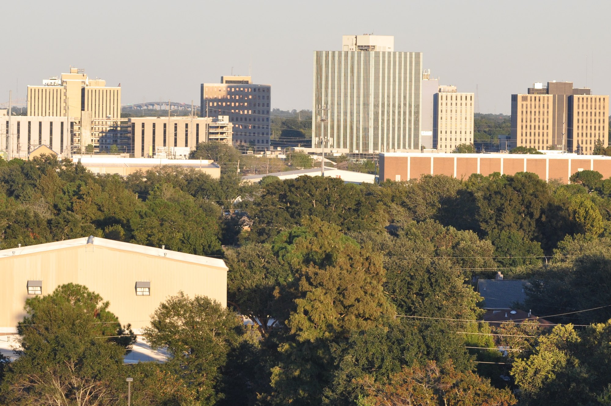
Metairie’s central business district viewed from the west

Outdoors

Wildlife viewing and birding near Metairie

Refuges, lakes and wild areas near Metairie for wildlife viewing and birdwatching.

22places to see wildlife
13 mito the closest
4within 30 miles

Good to know: Early mornings and evenings are best for wildlife; bring binoculars and keep a respectful distance.

Closest picks

1

Jean Lafitte National Historical Park and Preserve

13 mi south · National Park Service

In Jean Lafitte's day, silver and gold filled a pirate's treasure chest, but today's treasures are people, places, and memories. Discover New Orleans’ rich cultural mix. Learn Cajun traditions from people who live them.

2

Bonnet Carre Spillway

15 mi west · US Army Corps of Engineers

Over the years, the Bonnet Carre Spillway has developed into an extensively used outdoor recreation area with approximately 250,000 visitors enjoying the spillway each year.

3

Bayou Sauvage Urban National Wildlife Refuge

20 mi east · Fish and Wildlife Service

Bayou Sauvage Urban National Wildlife Refuge, established in 1990, contains a variety of wildlife habitats, including patches of bottomland hardwood forest; freshwater, brackish and estuarine tidal marshes; lagoons; canals; and natural…

Map of all 22 places

Map of 22 places loads as you scroll.

Within 30 miles (4)

13 mi south · National Park Service

Jean Lafitte National Historical Park and Preserve

In Jean Lafitte's day, silver and gold filled a pirate's treasure chest, but today's treasures are people, places, and memories. Discover New Orleans’ rich cultural mix. Learn Cajun traditions from people who live them.

  • Fishing
  • History
  • Hunting
  • Wildlife viewing

15 mi west · US Army Corps of Engineers

Bonnet Carre Spillway

Over the years, the Bonnet Carre Spillway has developed into an extensively used outdoor recreation area with approximately 250,000 visitors enjoying the spillway each year.

  • Biking
  • Boating
  • Fishing
  • Hiking
  • Nature education
  • Off-highway vehicles
  • Picnicking
  • Water sports

20 mi east · Fish and Wildlife Service

Bayou Sauvage Urban National Wildlife Refuge

Bayou Sauvage Urban National Wildlife Refuge, established in 1990, contains a variety of wildlife habitats, including patches of bottomland hardwood forest; freshwater, brackish and estuarine tidal marshes; lagoons; canals; and natural…

  • Birding
  • Boating
  • Fishing
  • Hiking
  • Hunting
  • Motor Boat
  • Non-Motorized Boating
  • Ranger programs

27 mi northeast · Fish and Wildlife Service

Big Branch Marsh National Wildlife Refuge

Big Branch Marsh National Wildlife Refuge, established in 1994, is located along the north shore of Lake Pontchartrain between the towns of Mandeville and Slidell, in St. Tammany Parish, Louisiana.

  • Birding
  • Boating
  • Fishing
  • Hiking
  • Hunting
  • Motor Boat
  • Nature education
  • Non-Motorized Boating

30 to 75 miles (3)

40 mi northeast · US Army Corps of Engineers

Pearl River - 3 Pools

Pearl River, LA is a series of three locks and dams. The area is primarily for day use with boating, hunting and fishing being popular.

  • Wildlife viewing

45 mi northeast · Fish and Wildlife Service

Bogue Chitto National Wildlife Refuge

Bogue Chitto National Wildlife Refuge, established in 1980, straddles the borders of Louisiana and Mississippi, bisected by the Pearl River.

  • Birding
  • Boating
  • Camping
  • Fishing
  • Hiking
  • Hunting
  • Motor Boat
  • Non-Motorized Boating

47 mi southwest · Fish and Wildlife Service

Mandalay National Wildlife Refuge

Mandalay National Wildlife Refuge conserves and protects freshwater marshes in western Terrebonne Parish in south–central Louisiana. The refuge's freshwater marshes attract thousands of migratory waterfowl.

  • Birding
  • Boating
  • Fishing
  • Hiking
  • Hunting
  • Motor Boat
  • Paddling

75 miles and farther (15)

78 mi northeast · National Park Service

Mississippi Gulf National Heritage Area

The Mississippi Gulf Coast is a culturally, historically, and environmentally distinctive region where many chapters in the national story have been written.

  • Boating
  • Fishing
  • History
  • Paddling
  • Swimming
  • Wildlife viewing

81 mi east · Fish and Wildlife Service

Breton National Wildlife Refuge

Breton National Wildlife Refuge is comprised of a sixty-mile long crescent of barrier islands, including Breton Island and the Chandeleur Islands, in the Gulf of Mexico, south of Gulfport, Mississippi and east of New Orleans.

  • Birding
  • Boating
  • Fishing
  • Hiking
  • Motor Boat

82 mi west · National Park Service

Atchafalaya National Heritage Area

Our country’s landscape is rich and mysterious. It is filled with twisting bayous, rivers and America’s largest river swamp. We have fields of sugar cane and cotton, ancient live oaks and towering cypress.

  • Biking
  • Boating
  • Camping
  • Fishing
  • Hiking
  • Paddling
  • Picnicking
  • Wildlife viewing

82 mi west · Fish and Wildlife Service

Bayou Teche National Wildlife Refuge

Located in the heart of the “Cajun Coast,” Bayou Teche National Wildlife Refuge, established in 2001, sits along Bayou Teche, an ancient channel of the Mississippi River.

  • Birding
  • Boating
  • Fishing
  • Hiking
  • Hunting
  • Motor Boat
  • Non-Motorized Boating

87 mi east · National Park Service · Campground

Davis Bayou Campground

Davis Bayou Campground is located east of downtown Ocean Springs, Mississippi, and is a part of Gulf Islands National Seashore. Visitors enjoy the campground for its easy access to boating, fishing, biking and hiking trails.

  • Biking
  • Birding
  • Boating
  • Camping
  • Fishing
  • Hiking
  • Kayaking
  • Picnicking

90 mi northwest · Fish and Wildlife Service

Cat Island National Wildlife Refuge

Cat Island is located near the town of St. Francisville, Louisiana, 30 miles north of Baton Rouge.

  • Birding
  • Fishing
  • Hiking
  • Hunting
  • Nature education
  • Non-Motorized Boating
  • Paddling
  • Ranger programs

96 mi east · Fish and Wildlife Service

Mississippi Sandhill Crane National Wildlife Refuge

The Mississippi Sandhill Crane National Wildlife Refuge was established in 1975 under authority of the Endangered Species Act to protect the critically endangered Mississippi sandhill cranes and their unique, and itself endangered, wet…

  • Birding
  • Educational Programs
  • Hiking
  • Nature education
  • Picnicking
  • Ranger programs
  • Wildlife viewing

99 mi west · Fish and Wildlife Service

Atchafalaya National Wildlife Refuge

Atchafalaya National Wildlife Refuge, established in 1984, is located in the floodplain of the Atchafalaya River, a tributary of the Mississippi that flows into the Gulf of Mexico.

  • Birding
  • Boating
  • Camping
  • Fishing
  • Hiking
  • Hunting
  • Motor Boat
  • Non-Motorized Boating

109 mi east · National Oceanic and Atmospheric Administration

Grand Bay National Estuarine Research Reserve

The Grand Bay Reserve is one of the most biologically productive estuarine ecosystems in the northern Gulf of Mexico and includes part of the Grand Bay National Wildlife Refuge.

  • Fishing
  • Paddling
  • Photography
  • Ranger programs
  • Swimming
  • Wildlife viewing

109 mi east · Fish and Wildlife Service

Grand Bay National Wildlife Refuge

Grand Bay National Wildlife Refuge is a study in transition. Here, the waterlogged wet pine savannas give way to the marshes, freshwater streams, and bayous of the Escatawpa River system.

  • Birding
  • Boating
  • Educational Programs
  • Hunting
  • Motor Boat
  • Nature education
  • Non-Motorized Boating
  • Paddling

110 mi northwest · USDA Forest Service · Campground

Clear Springs Recreation Area (MS)

This location is available on a first-come, first-served basis only. Visitors are required to physically arrive at the campground to purchase and claim a site.

  • Amphitheater
  • Biking
  • Camping
  • Canoeing
  • Fishing
  • Hiking
  • Kayaking
  • Mountain Biking

112 mi west · US Army Corps of Engineers

Atchafalaya Basin

The project encompasses 595,000 acres of the largest contiguous tract of bottomland hardwoods in the United States. The Atchafalaya Basin is a scenic semi-wilderness area of hardwood forests, cypress stands, marshes and bayous.

  • Boating
  • Hiking
  • History
  • Nature education
  • Off-highway vehicles
  • Picnicking
  • Water sports
  • Wildlife viewing

113 mi northwest · US Army Corps of Engineers

Old River Lock

Louisiana's Old River is a distinctive river with a remarkable history. Fifty miles northwest of Baton Rouge, it connects the Atchafalaya and Mississippi Rivers.

  • Boating
  • Hiking
  • Nature education
  • Off-highway vehicles
  • Picnicking
  • Water sports
  • Wildlife viewing

120 mi northwest · Fish and Wildlife Service

St. Catherine Creek National Wildlife Refuge

St. Catherine Creek National Wildlife Refuge was established in 1990. Management of the refuge aims to conserve the integrity of a dynamic bottomland hardwood forest ecosystem in the Lower Mississippi River Valley.

  • Birding
  • Fishing
  • Hunting
  • Photography
  • Wildlife viewing

131 mi northwest · Fish and Wildlife Service

Lake Ophelia National Wildlife Refuge

Lake Ophelia National Wildlife Refuge was established in October 2000 with the purpose of conserving and restoring habitat for migratory birds, aquatic resources, and endangered plants and animals. The Refuge consists of 17,500 acres.

  • Fishing
  • Hiking
  • Hunting
  • Nature education
  • Photography
  • Wildlife viewing

Distances are straight-line miles from downtown Metairie. Listings come from Recreation.gov’s federal recreation database; check each official page for hours, fees, fire restrictions and closures before you go.

Get outside around Metairie

More outdoors near Metairie

Questions

Where is the closest place for wildlife & birding near Metairie?

Jean Lafitte National Historical Park and Preserve (National Park Service), about 13 miles south of Metairie as the crow flies. Next are Bonnet Carre Spillway (15 mi) and Bayou Sauvage Urban National Wildlife Refuge (20 mi).

Who manages these places?

Federal agencies including Fish and Wildlife Service, National Park Service, US Army Corps of Engineers. Each listing links to its official page for hours, fees, closures and current conditions.

Metairie AI

Your Metairie local guide
Hey there!

I'm Metairie AI. Ask about neighborhood food, independent shops, local history or planning a visit.

AI recommendations may be inaccurate. Verify hours and prices. Questions are processed by Cloudflare. Privacy